There was a time when a map was a map. A large sheet of paper folded according to some ancient geometrical system designed to ensure you could never get it back into its original shape. You bought one at a gas station, spilled coffee on it and argued with whoever was sitting in the passenger seat about whether you had already missed the exit.
Those days may be numbered. The world of digital map mashups has moved well beyond the now-famous HousingMaps, which throws Craigslist listings onto Google Maps, and the Chicago crime map, which combines crime data from Chicago Police Department with Google Maps so you can see exactly where you probably shouldn’t leave the rental car.
And things are getting increasingly interesting. Weatherbonk (who comes up with these names?) piles weather information and live traffic feeds onto a map. The New York Times has experimented with a “Where to go” travel map. Placeopedia connects locations on Google Maps with their corresponding Wikipedia entries, essentially attempting to build a geographical Wikipedia of planet Earth.
It’s still primitive, and there are plenty of competitors circling the same territory, but the idea is compelling: click anywhere on the planet and find out what happened there, who lived there and why anybody should care.
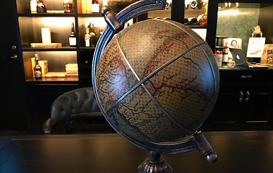 Will these analog globes be a thing of the past?
WikiMapia takes a slightly different approach. Instead of simply dropping pins onto the planet, users can mark entire areas and attach their own descriptions. Suddenly the map isn’t just something handed down by cartographers. Everybody gets a marker pen. This will presumably end well…
Google Maps has meanwhile added multiple destinations to its directions tool. A small feature perhaps, but an extremely useful one for those of us planning a journey more complicated than going from the airport directly to the hotel bar.
Then there’s Google Earth. Its recently added historical maps let you overlay old cartography onto the modern world and adjust the transparency, effectively allowing you to peel back time. You can wander through New York in 1836 or Tokyo in 1680 without cholera, wooden sandals or the inconvenience of inventing a time machine. Even the globe from 1790 turns out to be surprisingly accurate, particularly around Europe and the Mediterranean.
And because apparently mapping the entire history of human civilization isn’t enough, you can also spend December looking for Santa’s presents.
For the truly map-obsessed, Flash Earth lets you compare imagery from eight different mapping services, including Google, Yahoo, Ask, MSN, NASA and OpenLayers. Microsoft has its own answer with MapCruncher for Virtual Earth.
What will happen to the old globe sitting on the bookshelf? Maybe nothing. There’s still something satisfying about spinning a physical globe, stopping it with one finger and imagining what might be waiting there (except for accumulated dust).
But digital maps are becoming something entirely different. They’re no longer just instructions for getting from A to B. They’re turning into enormous geographical databases, layered with history, weather, photographs, crime, restaurants, apartments and whatever else somebody with an API and too much coffee decides to bolt onto them.
The map is no longer just the territory. It’s becoming the story of the territory.
Comments
No comments yet.
Leave a reply