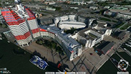
Google Street View and similar techniques are mainstream by now, and recently the Swedish site hitta.se was extended with a 3D view. By running a simple Java applet in your browser, you can zoom, pan and rotate the city while exploring street turns and roof constellations.
 3D view of my former office building in central Gothenburg.
The 3D models are created by C3 Technologies in Linköping, with technology previously used for military terrain analysis in missile guidance. Cars with eight cameras have been rolling through the streets, shooting in all directions. The height data was extracted using algorithms to analyze the photos and thus created the 3D environment. Sweet.
Related posts
Comments
No comments yet.
Leave a reply